October, 2024
Wednesday, October 16: Sacramento to Yosemite
Rain began falling east of Stockton. The region needs it to change the wildfire danger signs from EXTREME to SEVERE. The live webcam of Yosemite Falls yesterday showed a dry wall of granite tinged with a dark stain of lichen living tenuously off trickles of moisture from last season’s snowpack. For the sake of all that’s dry, I don’t mind driving in rain.
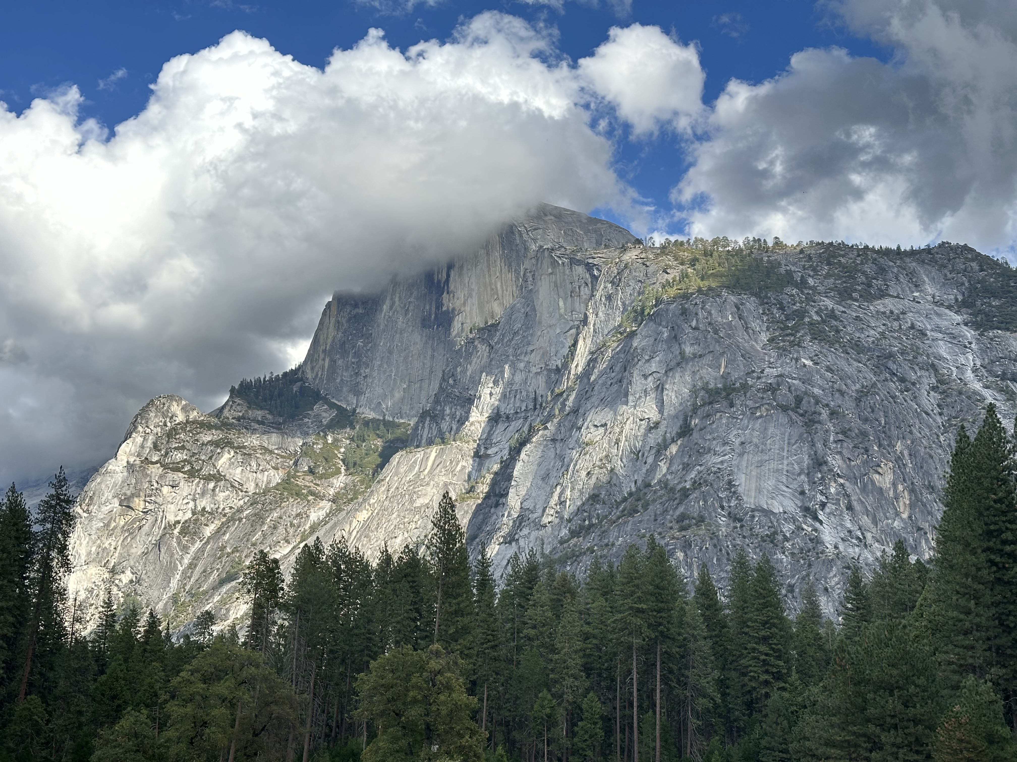
Approaching Yosemite, I realized my first glimpse of the iconic formations in the valley would be from an overlook on California Highway 120, not upon emerging from the tunnel on Wawona Road as my daughter and her mother had experienced. They drove from Fresno; I approach from the northwest, from Sacramento. I’m glad they experienced their first view of the park upon emerging from the tunnel. My daughter will be disappointed that I did not have the same experience. When I pulled off at the overlook and gazed into the valley, the icons stood shrouded in clouds.
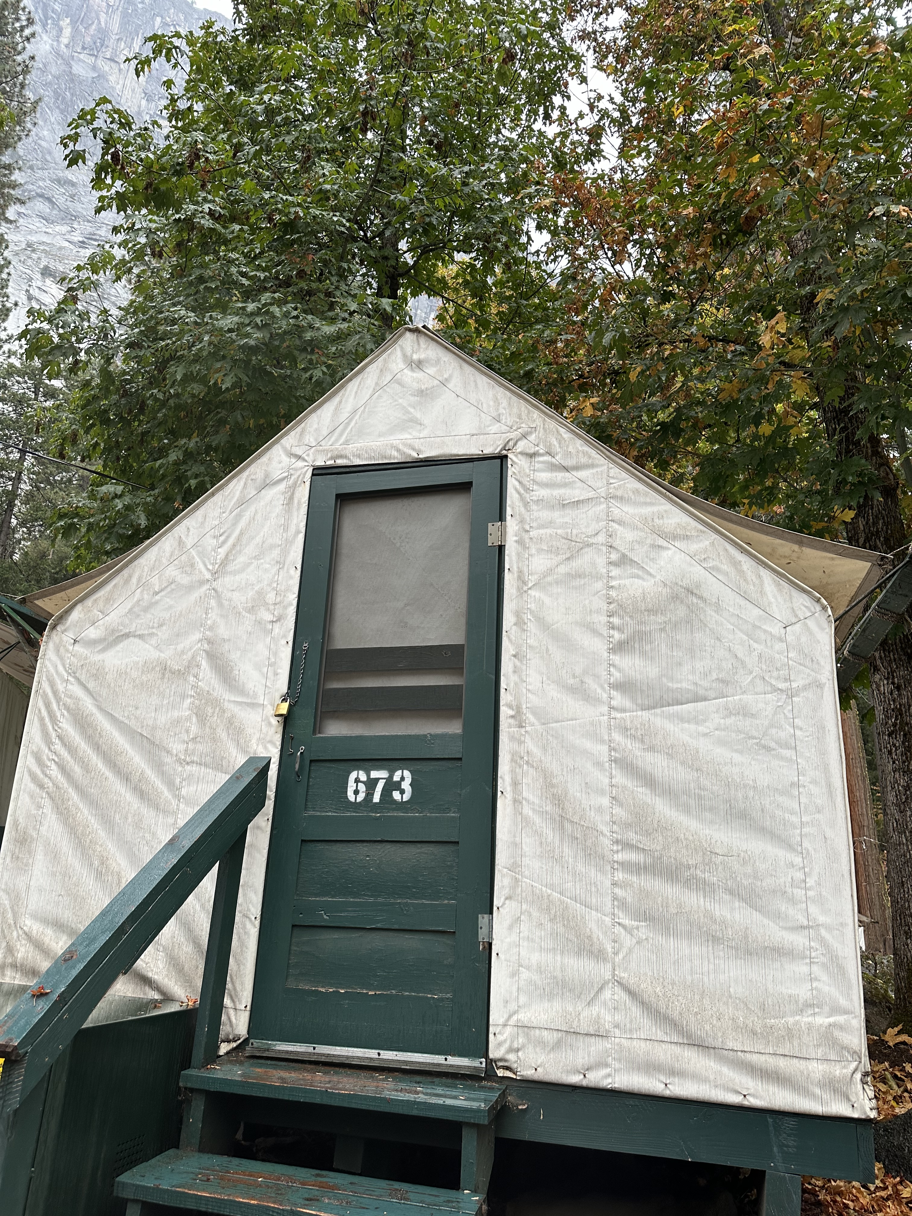
At the east end of Southside Drive, almost to the base of Half Dome, I parked in Curry Village and checked in to claim my cabin tent for two nights. Bianca, the young woman at the desk, assigned cabin 673, the same number as the address of my family’s home in Gainesville when I was a teenager, where my parents lived for 35 years. It is also the combination to the lock on the large suitcase full of hiking equipment in my rented Subaru. The cabin assignment struck me as a good omen.
Bianca explained how I needed to secure all scented items like food and toiletries in the steel bear box in front of my cabin. She gave me a map of the village, where hundreds of numbered rectangles represented crisp white tents on green frames. Their style evoked an earlier era. When I entered cabin 673, the sound of rain popping on taut canvas evoked every rainy camping trip I’ve ever experienced. Some of the very best trips included rain.
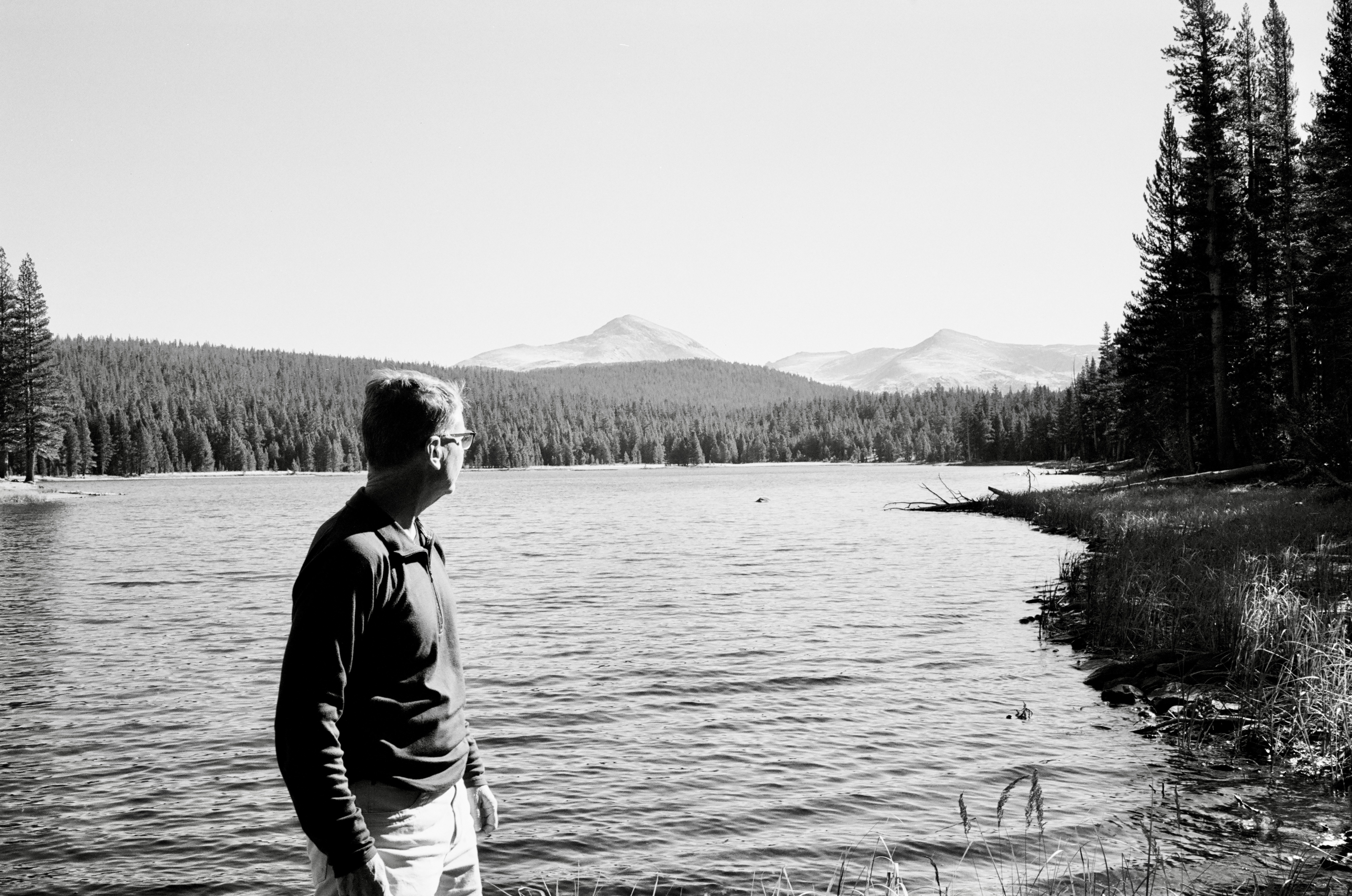
The rain moved out by sunset. I walked to Curry Village where I stood on the Pizza Deck, ate a slice of cheese pizza, and drank a mango-tinged beer called Half Dome. The real Half Dome glowed above me in mango-colored light as the sun emerged from clouds. Groups of visitors moved about, some chagrined at the day’s earlier weather, some pleased to have arrived after a long day of travel, and still others overwhelmed with the location as they assessed food options and took pictures with their phones.
Back in my cabin tent, I arranged my backpack and photographic gear for an early start on Thursday morning. I would rise at 4:30 AM; make a trip to the nearby bathroom; dress in layers against the morning chill; load up; drive an hour to Glacier Point; and watch first light touch the peaks and spill into the valley. I would see Yosemite from Glacier Point at sunrise just as Ansel Adams wrote in 1946 that he would like to show it to a visitor:
“If you were to give me the pleasure of showing you Yosemite Valley for the first time, I know just how I would want to do it. I would take you by night from the San Joaquin Valley up through the forested mountains and out to the Valley’s rim, so that when sunrise came you would be standing on Glacier Point. Up before dawn, you would lean against the railing, trying to see down into the shadows for the first sight of something whose descriptions you never quite believed.”
I would see Yosemite Valley the way Adams would like for it to be experienced. Then I would take photographs of the park.
On Wednesday night as I lay in bed making notes about my day, I soon found myself ready to turn out the single bulb in my tent. My nose felt cold, my body warm and dry. I nestled snug inside my 30-year-old North Face “Blue Kazoo” down sleeping bag, grateful I’d had the foresight to bring it. I had thought about this trip for a long time. My first impression, underscored by my great comfort in an uncomfortable environment, told me my planning had paid off.
Thursday, October 17: Sunrise at Glacier Point; Hiking Sentinel Dome; Curry Village
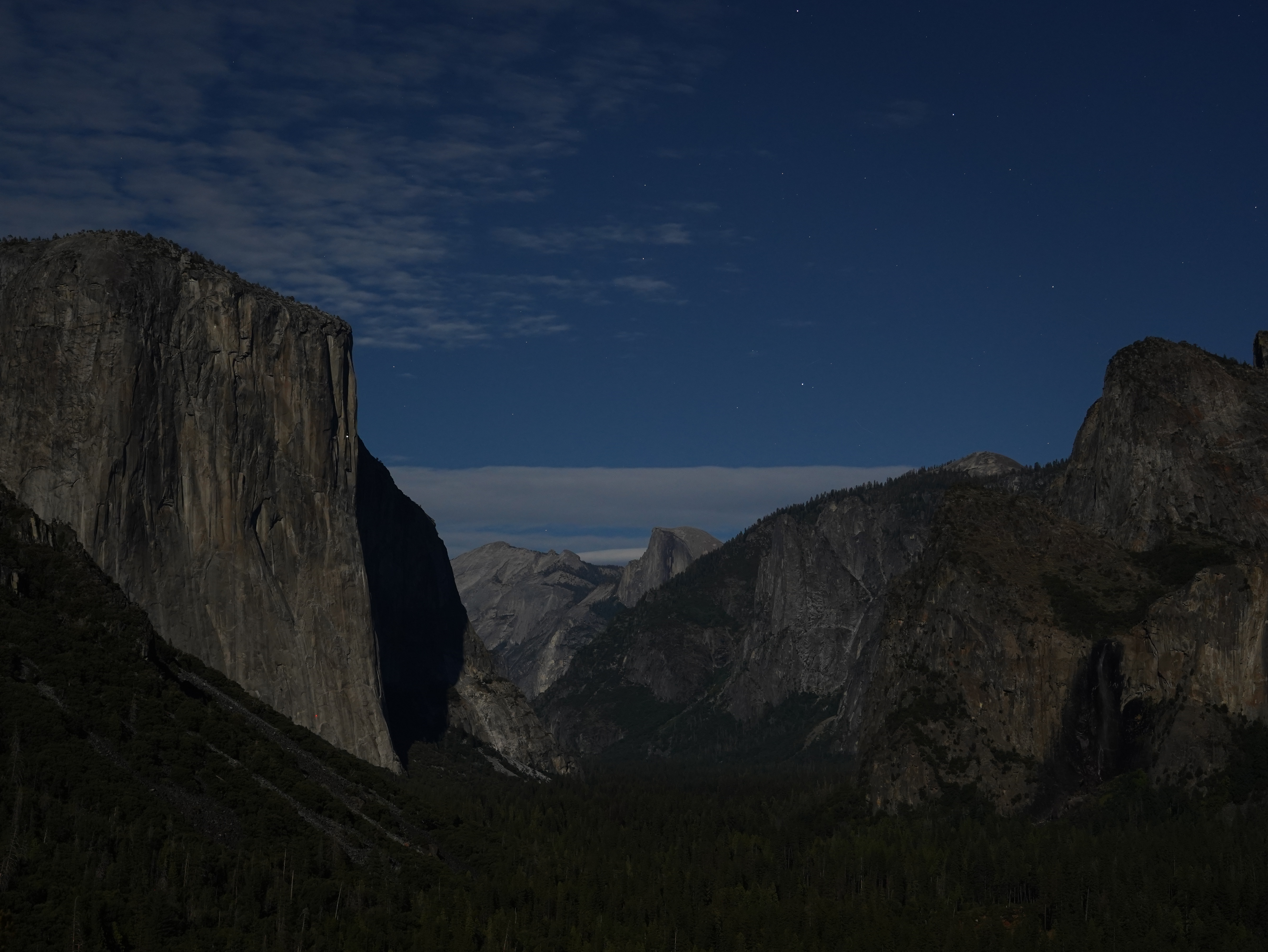
Two hours before sunrise I drove out Northside Drive and took Wawona Road up and out of the valley. Early in the climb I pulled off at Tunnel View to photograph the valley illuminated by full moonlight. Stars in the sky looked identical to a light on El Capitan where a climber had suspended a sleeping platform high on the granite face. The night scene before me and in the photos I captured impressed me more than a daylight scene would have, though daylight would have been cool, also.
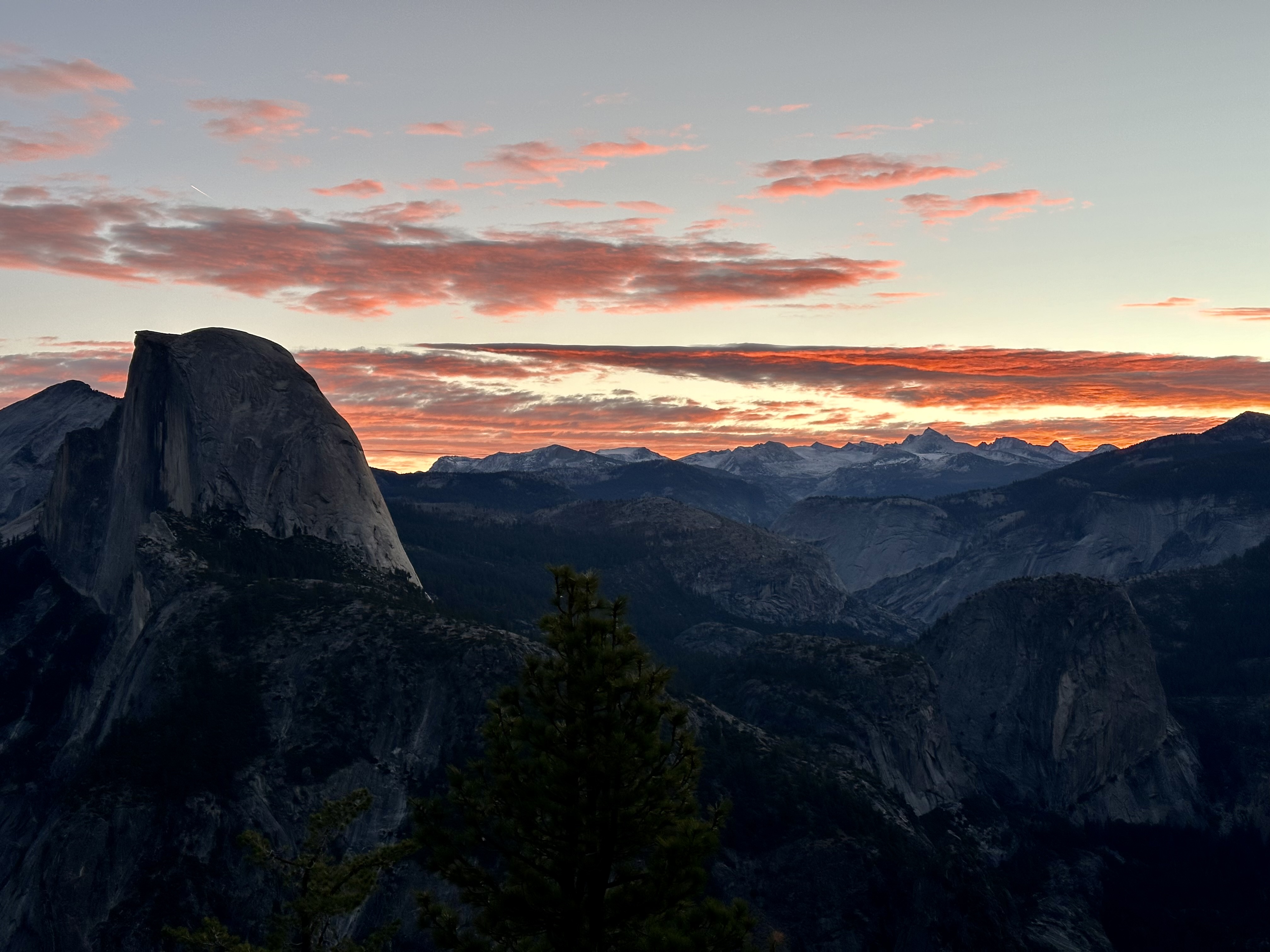
One hour of drive time and thirty-two hundred vertical feet later, I parked in the lot at the end of Glacier Point Road in full dark. I perceived the barest hint of astronomical twilight in a subtle bluing of the night-black sky. Maybe the blue came from moonlight, but the sun was on its way. I assembled my tripod, camera, and lens. Orion loomed above a stand of firs at the edge of the parking lot. A 4-second exposure captured the hunter in a sky more cobalt than a Chagall window.
The low full moon provided just enough light for me to navigate the paved paths at Glacier Point Overlook. I stepped off the walkway in front of Geology Hut and set up facing northeast toward Half Dome. Someone arrived behind me. I heard him get a camera out of his backpack and move about finding his spot. I turned and asked, “Am I in your field of view?”
“Oh, no, not at all.”
A few other people arrived, some with young kids. Some stood on the walkway, others stood above the rest of us in the Geology Hut itself. A couple about my age joined me in front of the walkway and set up to my right. Camera sounds came from several spots as people took test shots. Then the guy behind me said, “Excuse me, sir. When it gets a little lighter, would you take a picture of me with my camera?”
“Of course, I’ll be happy to. Just say when.”
The young man climbed over a rock and took a spot to my left. He introduced himself as Christian. I told him my name and asked, “Are you military, Christian?” He said he’s a Navy rescue swimmer, driving from Pensacola to his new duty station in San Diego. He had stopped to see several classic sights along the way. Yosemite is his last.
Christian had a Sony alpha 7S camera similar to my alpha 7C. He had the same 24-105mm Sony lens I was using. We began taking photos as the sky and a broken layer of clouds took on color. When we paused to admire the view undistracted by our cameras, Christian asked, “Have you ever seen the movie, “The Secret Life of Walter Mitty?””
That made me smile. “I have, several times. It’s one of my very favorites.” I knew he would quote Sean Penn’s character, Sean O’Connell, from the scene in which Ben Stiller as Walter Mitty asks Sean when he will take a photo of the snow leopard they’ve watched through Sean’s telephoto lens. Sean replies, “Sometimes, I don’t.”
Christian said he loved that movie, how the whole thing was about Walter looking for a single photographic negative, and the photo turned out to be a picture of him. “Walter was searching for himself,” he said. I liked Christian very much.
The photographer and her husband or partner to my right heard us talking about cameras and exposures. Susan introduced herself and asked me about my camera settings. We discovered she also had a Sony a7S like Christian, a Sony 24-105mm lens like both of us, and a Peak Design travel tripod like I was using. Susan turned out to be a very knowledgeable beginner, eager to learn more about her gear. I felt lucky to have such amiable people to talk with as we enjoyed the glorious sunrise and the small world it illuminated.
After photographing sunrise over Yosemite Valley with Christian and with Susan and her partner, I gave them each a card with my contact information. They seemed thrilled to have it. I hope to hear from them, see the photos they took that look just like mine, and keep in touch. In reality, though, their photos will differ from mine, and even if we make contact, we will not likely sustain contact for long. That’s too bad. They were nice.
I opened the hatch of my Subaru, screwed the propane canister onto my backpacking stove, and fired it up in the car’s cargo area. I set a pot of water atop the flame. Then I opened a packet of instant Starbucks coffee and poured it into my insulated cup along with cream from 4 mini-cartons of half-n-half. I got out my backpacking silverware, retrieved the spoon, and peeled the top off a single-serving cup of Quaker maple-brown sugar oatmeal. Soon, the sound of boiling water drowned out the sound of hissing gas. I turned off the gas, poured water into each container, sipped coffee while the oatmeal soaked, and enjoyed a fine tailgate breakfast. The hot food and coffee felt wonderful going down as I stood in 32-degree air with frost limning the edges of pine cones and windshield wipers.
After breakfast, I drove back the way I had come along Glacier Point Road to park at the trailhead for Sentinel Dome. Very few cars were in the spaces at 8:30 AM, but more than I expected. I readied my gear, extended my hiking poles, and opened AllTrails to track my progress on the Sentinel Dome and Taft Point Loop Trail.
The trail was easy to follow through open forest and across bare rock. Rusted steel signage with cut-out trail names made the route easy to follow. A few other hikers, mostly middle-aged, ambled along the trails. They passed me when I stopped to take photographs or look at a tree or large pine cone or the bright green lichen that clung like patches of Spanish moss to the trunks of huge pine trees. Then I passed the slower hikers when I set off along the trail again. We leapfrogged this way several times on the way to the top of Sentinel Dome.
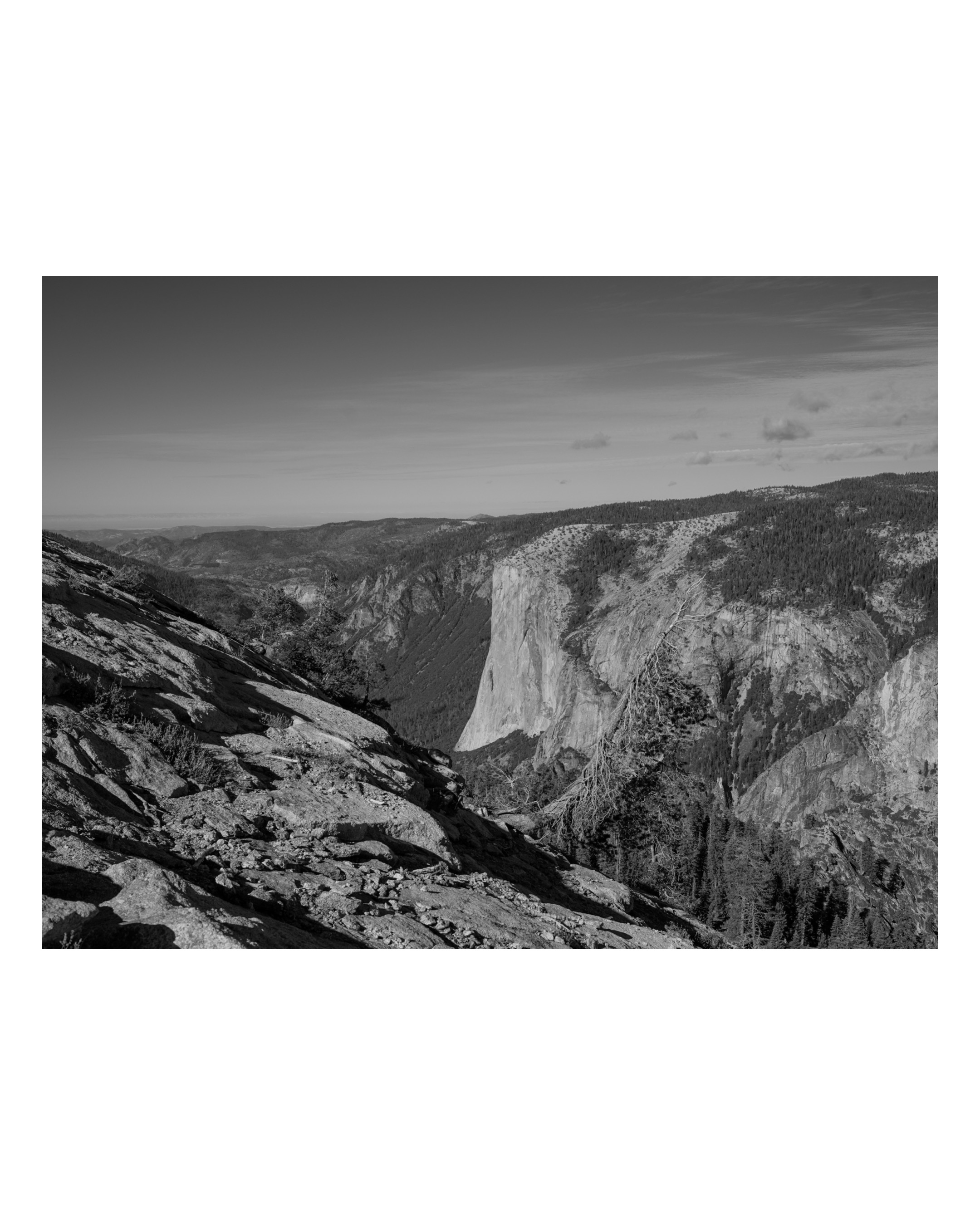
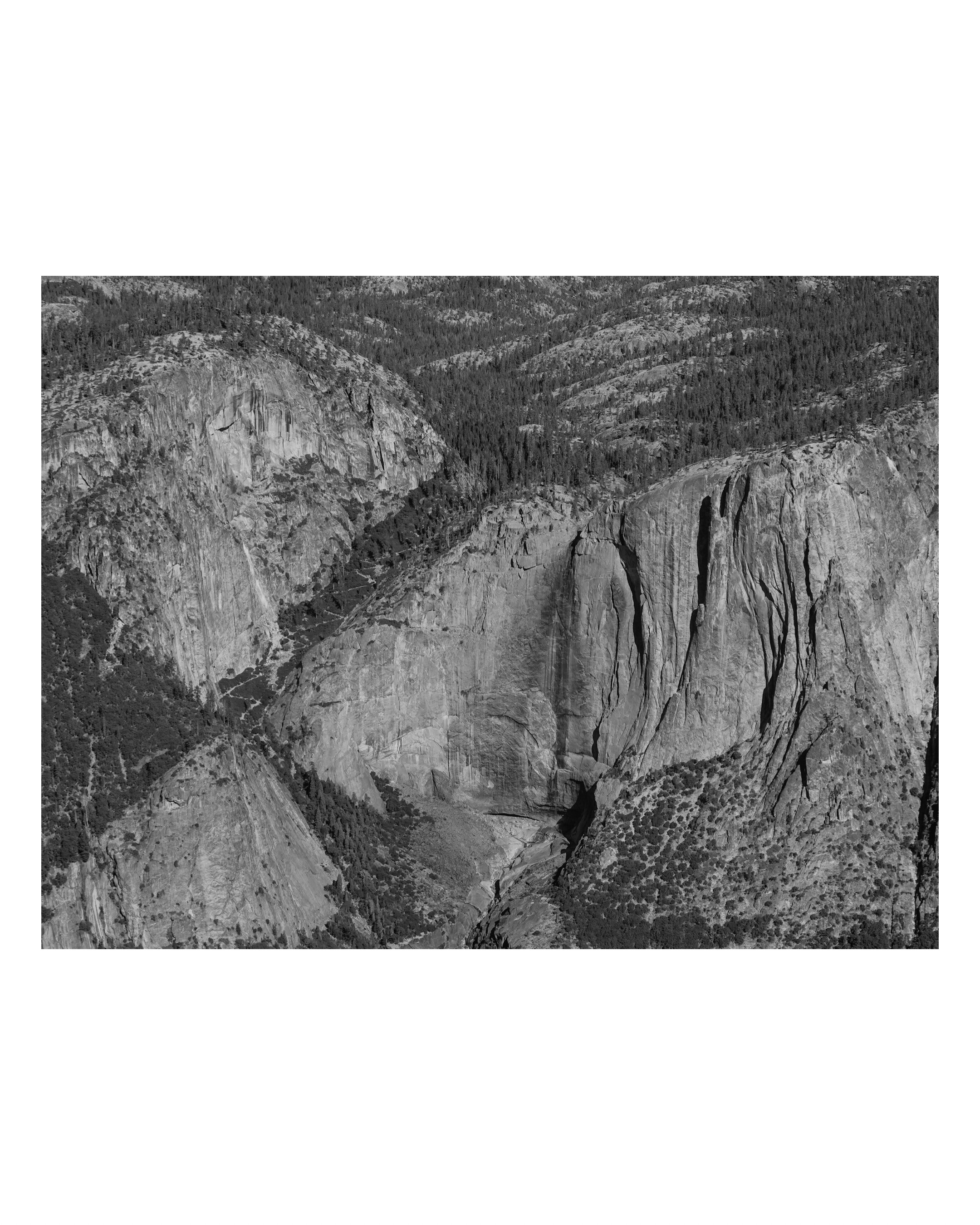
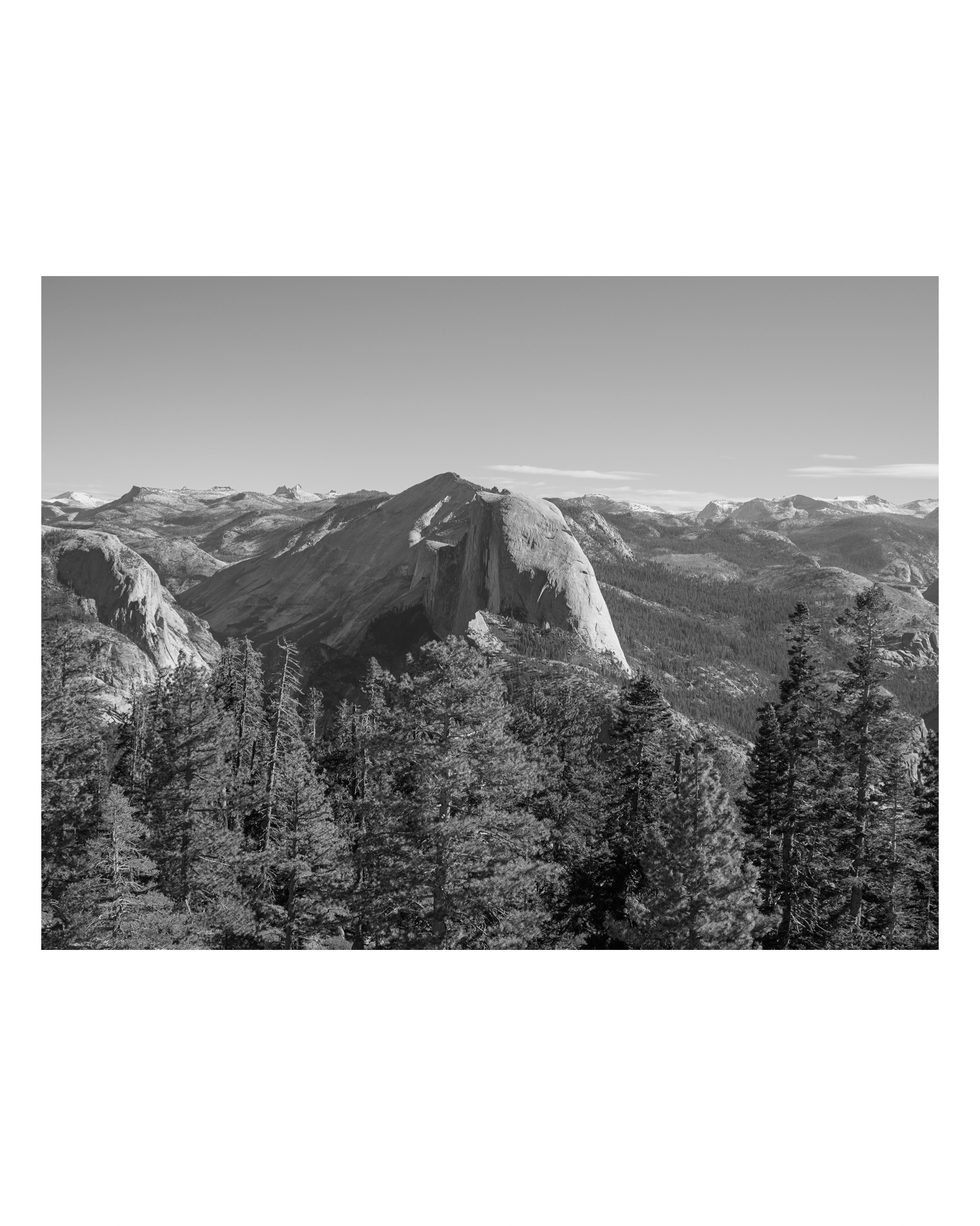
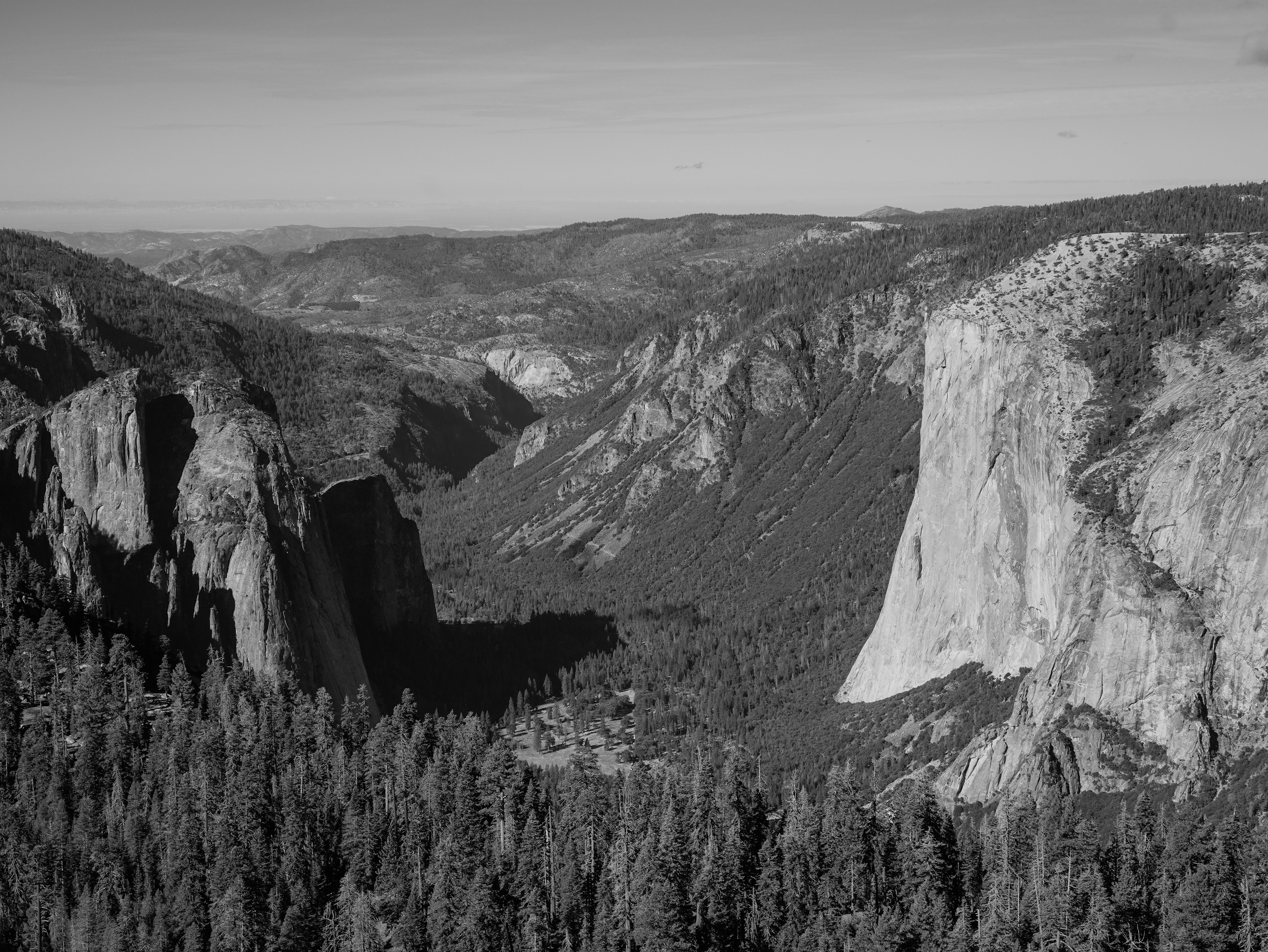
Atop the dome, I extended the legs on my tripod and mounted my Sony camera to photograph the spectacular views of Half Dome, Yosemite Falls, and El Capitan. All were diminished by a distance of about three miles, yet crystal clear in the morning air across a gulf of intervening space. Trees near the base of the three landmarks provided scale to attest to their significant height. I selected black and white from the camera’s creative style menu to emulate the photos of Ansel Adams. I also placed a red filter on my camera for several photos just as Adams had when inspiration struck him one day in the late spring of 1927. The resulting glass plate produced his staggering photograph titled “Monolith, The Face of Half Dome.” Although none of my photos rivaled those of Adams, the results pleased me very much.
In addition to capturing digital photos—and more in the tradition of Adams—I also made photographs on film. I took several frames each with my 1960 Leica M3 manual 35mm camera, and an Ondu 6×6 Pocket pinhole camera that uses rolls of 120 film. To avoid the risk of airport security machines ruining my film, I bought film early in the week from Mike’s Camera in Sacramento while attending a conference at the University of California Davis. Mike’s is a wonderful camera store, full of knowledgeable and helpful staff. They know cameras, film, and good restaurants in the cool Boulevard Park area of Sacramento. I thoroughly enjoyed tacos at Tres Hermanas based on a staff recommendation.
Because I was experimenting with settings and filters on both film cameras, I took notes. Many of the exposures disappointed me, while others pleased me very much. I learned a lot for my next visit to Yosemite as well as for other landscape subjects. Thinking about aperture, exposure time, and filters drew me into the process of capturing images in a way that digital photography, despite requiring the same decisions, often does not. Maybe it was because of having to write down my settings and wait several days to see the results, rather than seeing immediate feedback on a camera display, that internalized the photographic process. Concentration, notetaking, and delayed gratification entwined the creative experience with the place and my memory of it. I love the aesthetic of a black-and-white film image—and the process of producing the image.
While I fiddled with my pinhole camera pointed west toward El Capitan, a solo hiker about my age came up behind me. He took a spot just to my right. “Will I get in your way?” he asked.
“Oh, no.” I said. I gestured toward a better vantage point slightly in front of me. “I’m just making some adjustments. Take your time.”
“Thanks!” he said. He stepped up, took a single photo with his phone, and moved back out of my field of view. “Man, the views don’t get any better than this, do they?”
“They sure don’t!” I said. “You can see all the major points of interest from here. Sentinel Dome is great.”
“I think so, too. I’ve hiked all over these rocks,” he said, gesturing. “El Capitan, Half Dome. I’ve camped all over them, and I think this is the best view of everything.”
We chatted a moment more. The guy looked familiar: lean, tall, fit. Blond hair going gray. Stubble on flat cheeks, strong jaw, square chin. “Well, enjoy your day,” he said. He raised his arm, turned, and walked east to descend the way he’d come.
I turned back to my camera. When the guy was well out of sight, recognition struck me: I think that was Conrad Anker. Damn.
I wrapped up my photo capturing and descended Sentinel Dome to pick up the loop trail. Going counter-clockwise, I was disappointed not to run into the solo hiker again so I could ask his name. I ran into several groups, though, including six slow retirees talking about golf, a couple of young families with tweens, two eastern-European families, and one group of young men carrying no visible water bottles or packs, just a cylindrical Bluetooth speaker playing heavy base hip-hop music. Mercifully, the music had no lyrics.
Hunger came on strong about the time I reached my car. I repeated the breakfast drill to prepare a tailgate lunch, this time boiling water to rehydrate a meal of Kung Pao Chicken. I drank a cup of coffee while the meal slowly absorbed the hot water. Then I ate both portions of the two-serving package. It was delicious. No fortune cookie, but I know exactly what the strip of paper in a cookie would have said: You will see wonders.
After lunch I drove back to Yosemite Valley, reaching the village by mid-afternoon. I showered in the grimy shower facility in the tent village, changed, and got comfortable in the Curry Village Lounge—a building reminiscent of a small hunting lodge—where I could download photos from the SD card of my Sony camera and connect to WiFi. I saw no signs against food or drink, so I walked across the space between buildings and got a beer from the Pizza Deck before settling in to my tasks.
The digital photos I had taken looked pretty decent. I deleted dozens of bad or less-good ones, saving the harder decisions for the long plane ride home. I chatted via text a bit, transcribed some of my notes about the day, and tried to ignore the low-talking couple at the next table. After a while I packed up and wandered out to explore the valley close to Curry Village.
I was pleased to discover a boardwalk that crossed a meadow and led north toward the Merced River and the Ahwahnee Hotel. My daughter and her mother stayed in the hotel on their visit. I didn’t walk all the way there to check it out, but on my next visit I will likely select the Ahwahnee over a cabin tent. The cabin tents aren’t cheap, and the hotel is surely much more expensive. However the bathrooms and showers in the tent village are worse than in many of the lesser state parks I’ve visited. A clean, private bathroom and shower will be worth the difference in cost the next time I visit Yosemite.
The boardwalk offered a wonderful view of Half Dome to the east and the high walls of the valley to the west. Several other park visitors and I took pictures of Half Dome. Cumulus clouds banked behind the monolith. One cloud moved in to shroud its top, which made for a great photo. I explored a little more, then toward sunset I returned to the boardwalk to see a band of orange-gold light illuminating Half Dome’s lower third. The band moved up as the sun went down, and the setting sun set the clouds to the west on fire. The orange in east and west flared in concordance, affording visitors stunning views in both directions.
My appetite rose as the sun set. I walked back to the Pizza Deck and ordered a General Sherman IPA and a small veggie pizza with mushrooms, onions, green peppers, and black olives, just like I used to get from Donelli’s in Woolwich, Maine. The veggie is a delicious pizza. I don’t understand why it doesn’t outshine the bougie Pizza Margherita or the awful, plebian, heartburn-inducing pepperoni pizza. Go figure. I ate two of my veggie’s four slices, drank my mediocre beer, and saved the other two slices of pizza for breakfast. They would keep just fine in 40-degree night air in the bear locker outside my tent.
Although tired enough to turn in early and read in bed, I decided instead to walk back out to the boardwalk in deepening twilight in the hope of photographing Comet C/2023 A3 Tsuchinshan-ATLAS. The comet was moving away from the sun, setting a bit later each night, which placed it higher and higher in the evening sky even as it grew more faint. On this night, I figured, it would be high enough at the end of twilight to be visible above the high walls of the valley. Thankfully, it was.
I set my small LED lantern to its red light setting and placed it at the foot of my tripod so no one on the boardwalk would bump into it. Then I secured my camera on top and aimed it west to capture the comet. It appeared to the naked eye as a faint whisp almost paralleling the slope of the valley’s southern wall. People stopped to ask what I was photographing. They marveled at my camera’s display when I showed them, and marveled again when they saw the faint streak low in the western sky. “Go ahead and try it with your phone,” I said, and they did. “Oh, thank you!” they said. “That’s so cool!”
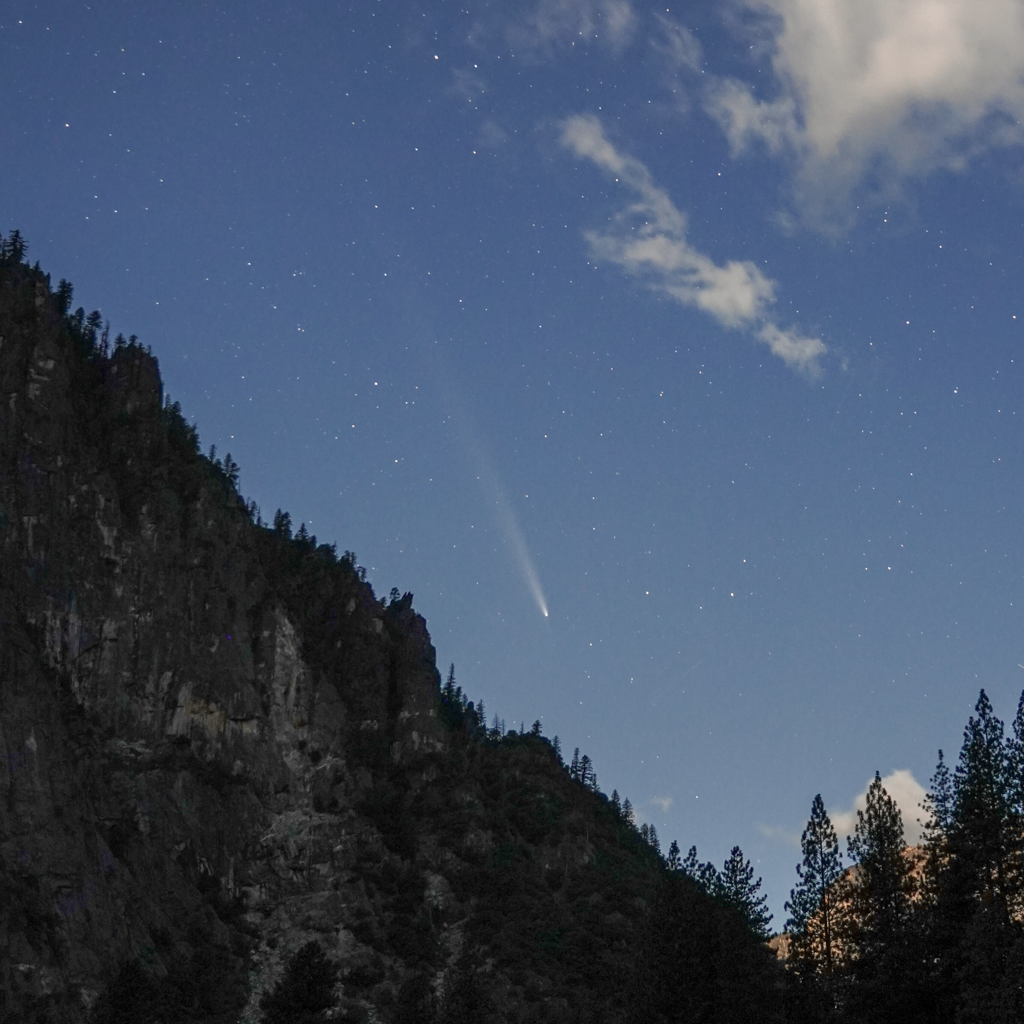
The comet sank lower, so I turned toward Half Dome to try for a picture of the super moon rising behind it. Persistent clouds shrouded the granite dome and covered the sky beyond it. Moonlight illuminated the structure of the clouds, but the moon didn’t show. I packed up for the night and walked back to my cabin tent where I would review my comet photos before going to bed. As I walked, I realized the imaginary fortune cookie at lunchtime had described my day perfectly: I had seen wonders.
Friday, October 18: Yosemite Valley to Elk Grove/Sacramento
I woke well before dawn. I arranged my gear and packed to leave Yosemite after my second day in the park. In the afternoon I would drive to Elk Grove, near Sacramento, from which I would have an easy drive to the airport for my flight home on Saturday.
The air was chilly, 43 degrees. I loaded the car in the dark, cooked a tailgate breakfast of oatmeal and a cup of coffee, checked out of Curry Village, and got under way.
My plan for the day would take me to a very different section of the park. I would drive out Northside Drive, pick up Big Oak Flat Road the way I had come in, but well before reaching the northwestern park exit on California 120 I would turn right onto Tioga Road. I would follow its steady climb to Tuolumne Meadows northeast of Yosemite Valley. After a morning hike near Lembert Dome, I would continue northeast through Tioga Pass. Then I would descend into Mono Basin and stop for lunch at the Whoa Nellie Deli.
The air got colder as I climbed, the wind picked up. The car’s information panel showed an outside air temperature of 32 degrees. It must have been much colder overnight. I saw one icy patch on the road, and an accident which had put a truck nose-first down a bank on the westbound side of the road and a car on its door against a bank on the eastbound side.
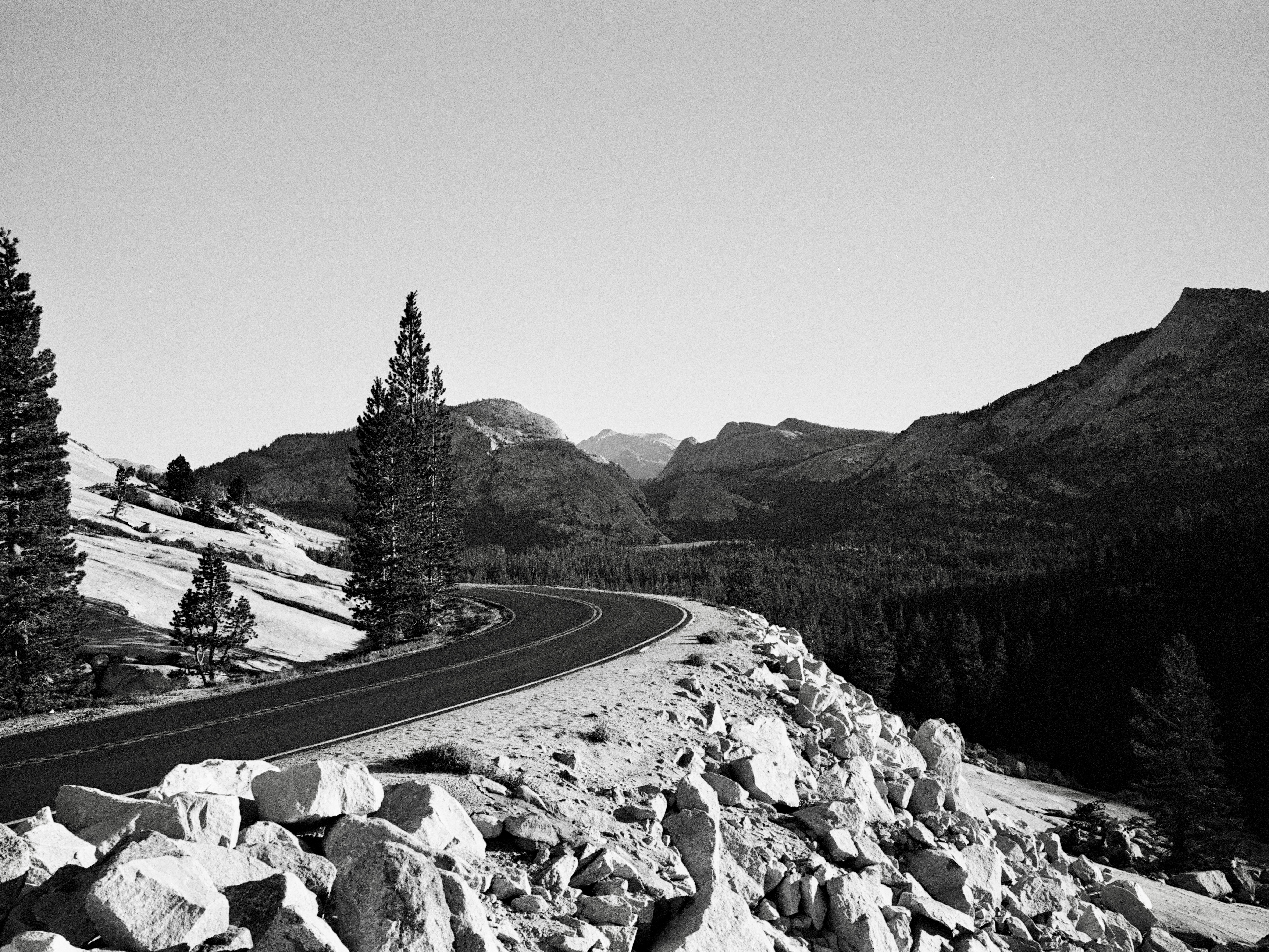
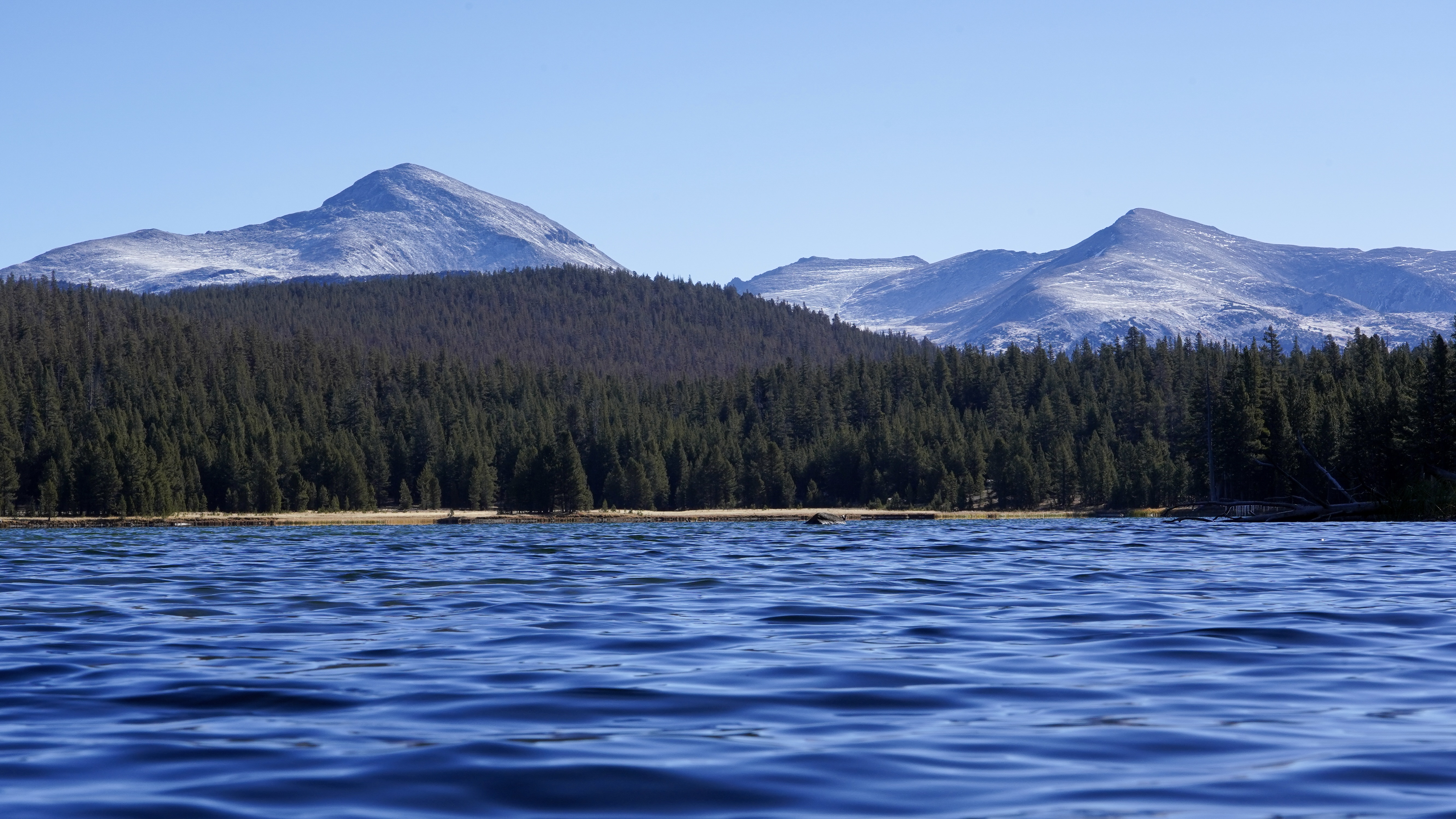
Wind blew emphatically at Olmsted Point. My Subaru shuddered while I got my camera ready. I got out with my Leica, glanced at the plaque describing the site, and took in the otherworldly view of stark white rocks, strong evergreen trees, jagged and scoured mountains. I took light readings and snapped three photographs. One photo of Tioga Road curving away from Olmsted Point is one of my favorites from the trip. It suggests the doppler sound of a high performance automobile—a Ferrari or an Aston Martin—approaching, accelerating out of the turn, and disappearing around the next bend.
I got back in the car, drove past the windswept water of Tenaya Lake, slowed to admire the golden expanse of Tuolumne Meadow, and parked at the Lembert Dome Trailhead. I planned my layers carefully so I could shed them and not overheat. Then I hefted my daypack and set off on the short trail to Dog Lake, an out-and-back route 1.6 miles each way.
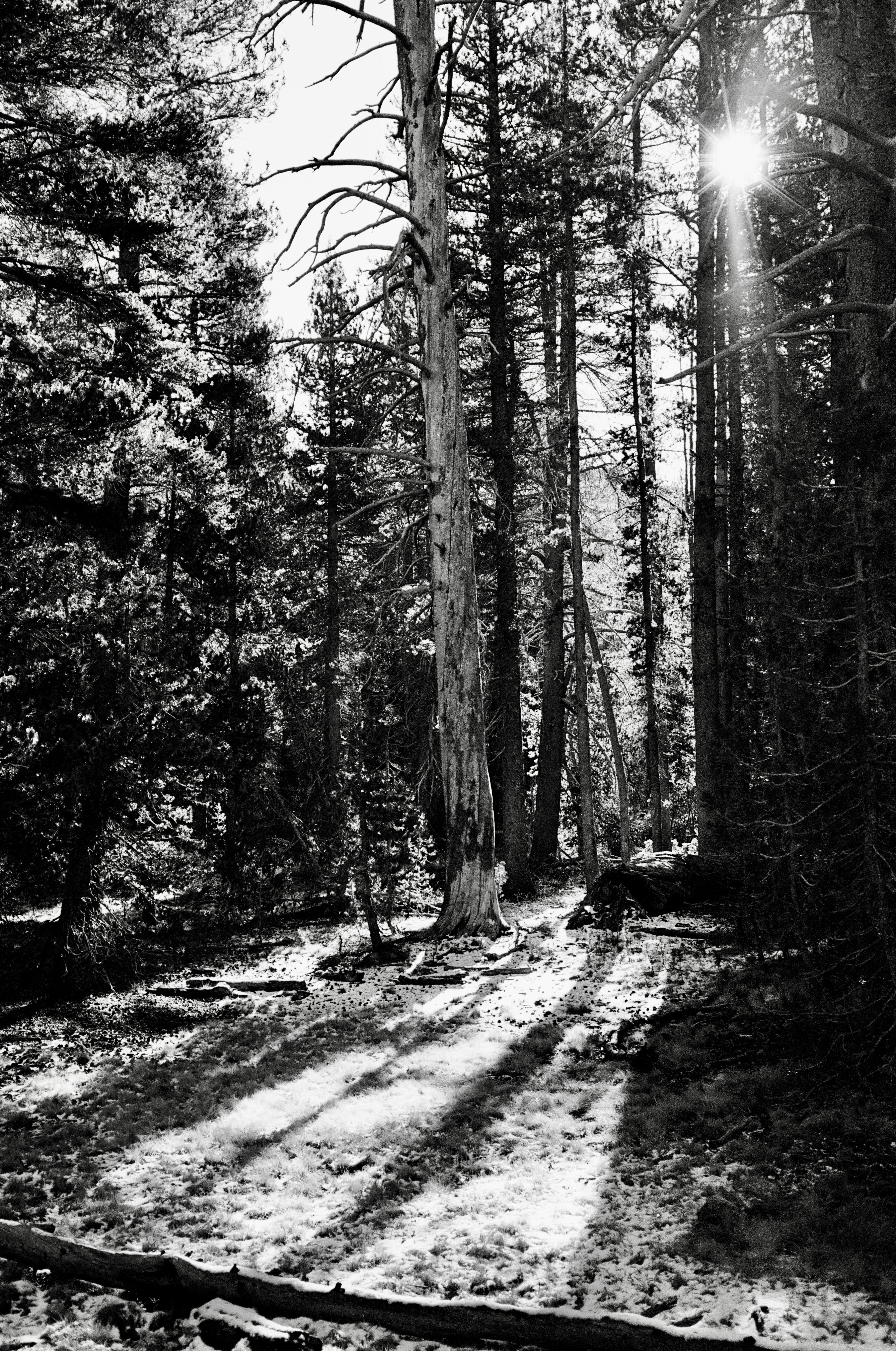
The strong wind subsided, especially in the woods. As the trail climbed, I began to see patches of snow on the ground. One forest glade looked especially picturesque, with sunbeams streaming through the trees onto dry yellow grass and a thin layer of snow. It was the kind of spot to which I would like to bring a lovely companion, pitch a tent, and listen to night sounds together. I find places like this much more easily than I do a partner with whom to share them. Anyway, I stopped to photograph the glade on film, and to shed my outer jacket.
By the time I reached Dog Lake I had also shed my gloves and watch cap. I set up the tripod, took digital and film selfies, took photographs without me in them, then just stood and admired the scene. Waves on the water near me resembled the undulations of terrain and forest on the far side of the lake, which suggested the waves of two mountains in the near distance. Undulations on vastly different time scales, all eventually settling to a calm.
From Lembert Dome I continued my drive east and then north, past Dana Meadows to Tioga Pass at 9,944 feet. Cars stopped at a ranger booth to enter the park from the east. Exiting, I drove right through and began the long descent to the tiny town of Lee Vining in the Mono Basin.
Just past noon, I ate lunch at the Whoa Nellie Deli in the Tioga Gas Mart Mobil station. The station is remarkably clean—a cleanliness I suppose they can afford based on the price of the gasoline. At $6.59 per gallon, it was the most I’ve ever paid for gas.
Every time I thought of the name of the Whoa Nellie Deli, I heard Keith Jackson’s distinctive baritone voice remarking on a surprising college football play. I also thought of my dear friends, Sylvia Pierson and her late husband, Brett. Brett was my plebe year roommate at the U.S. Naval Academy, and one of the best friends I’ve ever had. Maybe THE best. Sylvia married into the best friend role and occupies it still. They both heartily endorsed the lobster taquitos at this uncanny source for seafood. So, while reluctant to try anything containing lobster when so far from the sea, or gas station seafood under any circumstances, I acquiesced based on a credible recommendation. I must admit: the lobster taquitos at the Whoa Nellie Deli are indeed quite tasty. “Whoa, Nellie!” as Keith Jackson would have said.
I drove out of Lee Vining headed north on U.S. 395. At Bridgeport, 395 turned left. I continued through Sonoma Junction and stopped at the Walker Coffee Company in the unincorporated town of Walker. Several Native Americans, some speaking a native language, sat at a table. A young Native American man took my order. He and the others had the most beautiful timbre to their voices, and were very welcoming to this obvious outsider.
Coffee in hand, I drove on to Colesville, then Topaz. At Topaz I turned left on California 89, drove through Markleeville and Woodfords, turned left on California 88/89, then right on 89 toward Lake Tahoe. Most of this route passed through the Humboldt-Toiyabe National Forest that straddles the Nevada-California state line. The National Forest includes several wilderness areas and historic sites. In mid-October, the yellows of aspen groves struck the eye like all the days of sunlight they had absorbed since leafing out in spring. On the high, curvy roads, it amazed me to see stretches where the state of California has determined a guardrail isn’t necessary. A few miles of guardrail would have made me feel much better on that clear, sunny Friday afternoon. I can’t imagine driving those roads on a dark and stormy night.
Northbound, approaching South Lake Tahoe, I exited a traffic circle to pick up U.S. 50 West. Strands of silk drifted through afternoon glare as spiders traveled on the wind. I drove downhill through Placerville, with its annoying stoplights on the freeway. With half an hour to spare before its closing, a U.S. Post Office in El Dorado Hills accepted my two mailers containing rolls of film addressed to The Darkroom so I wouldn’t have to carry them through airport security, which surely would have ruined the exposures.
With my film safely mailed, I breathed a sigh of relief. I turned out of the Post Office and cut cross-country toward Elk Grove on the south side of Sacramento, where I checked in to the Fairfield Inn. I walked to a food truck and bought three tacos al pastor for supper, ate them in my room, then took a shower. To close out the long day, I sorted and re-packed all of my gear. Then I went to bed. I dreamed of vast space, long views, curving roads, precipitous drops, the best way to reach a new destination, and the unique route we must each navigate to go home.